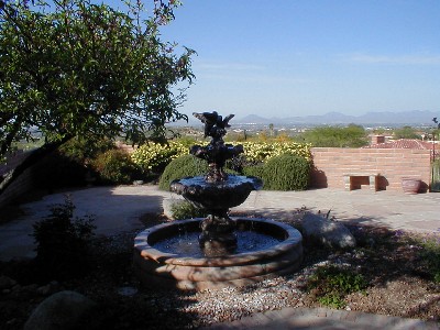
SUNRISE MTN RIDGE'S 7 DAY DETAIL FORECAST FOR TUCSON FOOTHILLS, AZ.
National Weather Service Forecast for:
Catalina Foothills, AZ
Issued by: National Weather Service NWS Tucson Arizona
Updated: 11:32 pm MST Sep 04, 2026
Sunrise Mtn Ridge Tucson Az
Saturday
Mostly Sunny
Sunday
Sunny
Labor Day Slight Chance Showers And T-Storms
Tuesday
Chance Showers And T-Storms
Wednesday
Chance Showers And T-Storms
Thursday
Chance Showers And T-Storms
Friday
Chance Showers And T-Storms
Hi 96 °F
Hi 99 °F
Hi 100 °F
Hi 100 °F
Hi 99 °F
Hi 96 °F
Hi 94 °F
Overnight
Partly Cloudy
Saturday Night Partly Cloudy
Sunday Night Slight Chance Rain Showers
Monday Night Slight Chance Showers And T-Storms then Partly Cloudy
Tuesday Night Chance Showers And T-Storms
Wednesday Night Chance Showers And T-Storms
Thursday Night Chance Showers And T-Storms
Lo 72 °F
Lo 74 °F
Lo 77 °F
Lo 76 °F
Lo 76 °F
Lo 74 °F
Lo 74 °F
Overnight
Partly cloudy, with a low around 72. South southeast wind around 3 mph.
Saturday
Mostly sunny, with a high near 96. Southwest wind 1 to 10 mph.
Saturday Night
Partly cloudy, with a low around 74. North northeast wind 2 to 9 mph.
Sunday
Sunny, with a high near 99. West southwest wind 1 to 12 mph.
Sunday Night
A slight chance of rain showers between 11pm and 5am. Partly cloudy, with a low around 77. North northeast wind 2 to 10 mph.
Labor Day
A slight chance of showers and thunderstorms after 11am. Mostly sunny, with a high near 100. Chance of precipitation is 20%.
Monday Night
A slight chance of showers and thunderstorms before 11pm. Partly cloudy, with a low around 76. Chance of precipitation is 20%.
Tuesday
A chance of showers and thunderstorms after 11am. Mostly sunny, with a high near 100. Chance of precipitation is 40%.
Tuesday Night
A chance of showers and thunderstorms before 5am. Partly cloudy, with a low around 76. Chance of precipitation is 40%.
Wednesday
A chance of showers and thunderstorms after 11am. Partly sunny, with a high near 99. Chance of precipitation is 50%.
Wednesday Night
A chance of showers and thunderstorms before 5am. Mostly cloudy, with a low around 74. Chance of precipitation is 50%.
Thursday
A chance of showers and thunderstorms after 11am. Mostly sunny, with a high near 96. Chance of precipitation is 30%.
Thursday Night
A chance of showers and thunderstorms. Partly cloudy, with a low around 74. Chance of precipitation is 30%.
Friday
A slight chance of rain showers before 11am, then a chance of showers and thunderstorms. Partly sunny, with a high near 94.
Forecast from NOAA-NWS
for Catalina Foothills, AZ.
Tucson, Az - Area Forecast Discussion
Forecast Discussion for TWC NWS Office
647
FXUS65 KTWC 042031
AFDTWC

Area Forecast Discussion
National Weather Service Tucson AZ
131 PM MST Fri Sep 4 2026

.SYNOPSIS...Expect isolated to scattered thunderstorms each
afternoon and evening into early next week, with a potentially more
active period later next week. The main threat will be heavy
rainfall leading to areas of flash flooding. High temperatures will
will fluctuate between near normal and a few degrees below normal.

&&

.DISCUSSION...Isolated to scattered showers with a few thunderstorms
are ongoing as of this writing south and east of Tucson. However,
the storms for the most part are struggling today as some modest
warming/drying aloft is resulting in a bit of subsidence/capping,
keeping the vertical growth of the storms in check. There just isn`t
much in the way of larger scale lift or forcing to help things along
today. However, with additional daytime heating, still can`t rule
out an isolated stronger storm or two through the afternoon with
main concern still being heavy rain and isolated flash flood threat.
Tucson will be on the western periphery of any activity with
any storms diminishing fairly quickly this evening after sunset.

Above normal moisture levels will continue for early September
Saturday through Monday with PWAT values mostly in the 1 to 1.5 inch
range across our forecast area with some modest assistance from
Hurricane Marie well southwest of Baja California. While moisture
will continue to remain elevated this weekend, there remain no well
defined triggers or lift to enhance showers and thunderstorms with
modest instability levels as mid/upper level ridge axis nudges into
SE Arizona. Expect isolated to scattered showers and thunderstorms
each day, mainly to the south and east of Tucson where there is
better instability. Locally heavy rainfall will continue to be the
main threat.

Thereafter, from Tuesday and continuing through the rest of the work
week, it`s shaping up to be a potentially more active period as a
more established lower to mid level southeasterly flow sets up with
potential tropical influence from a possible system near southern
Baja. Plenty of time to keep an eye on this but no sign of Monsoon
2026 letting up as we head through the next week to 10 days.

Temperatures will be within a couple of degrees of normal through
Wednesday, then dropping to below normal levels late next week.

&&

.AVIATION...Valid through 06/00Z. SCT to locally BKN clouds 7-12k ft
AGL through much of the forecast period, mainly KTUS eastward.
Isolated to Scattered TSRA/SHRA thru 05/03Z then diminishing
overnight, with Isolated to scattered SHRA/TSRA mainly south and
east of KTUS aft 05/19Z. Near any thunderstorm will have strong
gusty winds, heavy rainfall, and brief lowering of ceilings. Outside
of thunderstorm winds, winds will be south to southwesterly thru
05/06z and west to northwesterly 6-12 kts aft 05/18z. Light and
terrain driven at other times. Aviation discussion not updated for
TAF amendments.

&&

.FIRE WEATHER...Expect daily scattered thunderstorms each afternoon
and evening into early week. There will be some variation in
coverage day to day, but expect the bulk of the activity from
central Pima County eastward. Heavy rainfall leading to flash
flooding will be the main threat. Temperatures will be around normal
to a few degrees below normal into early next week. Minimum relative
humidity values mainly 20 to 45 percent in the valleys and 30 to 60
percent in the mountains over the next week. Winds will generally
remain less than 15 mph and terrain driven through the week.

&&

.TWC WATCHES/WARNINGS/ADVISORIES...None.

&&

$$

Visit us on Facebook, X, YouTube, and at weather.gov/Tucson