Skip to main content.
Currently:64.9°F Sunny, Dry
Sunny, Dry
Comfort Index: ---
 Updated02-Dec-2024 10:15am @ 
 
Time of Next Full Update: 10:20 am -  Station Elev: 1469 ft  
Pepper Ridge North Valley - SWN Navigation Menu
Pepper Ridge North Valley - Main Naviagation Menu

Weather Links:

       Home Page 

      Current Weather 

           Forecast Page 

          Historical Data

           Live Lightning 

            Monsoon Info 

        Satellite/Radar 

       Station Info

     Tropical Weather

        Weather Ed. 101 

          Weather Links 

      Weather Photos 

  Weather Warnings

       More Wthr Links 

Us Flag

New FeatureNew Feature
N.O.A.A Radio

Celebrating
15+ Years on the web
2005 - 2021

& 20+ Years of Data
1997 - 2021
At Pepper Ridge

 Weather Reports: 
Monsoon 2024New Feature
 Highlights. 

Monsoon 2021New Feature
 Wrap Up Review. 

Monsoon 2020
 Wrap Up Review. 

Monsoon 2015
 Review. 

Side Bar Php

Current Conditions

@ 02-Dec-2024 10:15am
64.9°F Warmer 5.7°F than last hour.
Temp Change: °F /hr
Sunny, Dry  Sunny, Dry
Feels Like: 65 °F
Humidity: 30%Decreased 4% since last hour.
Dew Point: 32.7 °FIncreased 2°F since last hour.
Wind: Calm
---

 mph
Gust: 0.0 mph
Pressure: 30.14 in Rising 0.003 inHg/hour
Steady
Solar Rad: 100%
434 W/m2
UV Index: 1.1
 Low 
Rain Today: 0.00 in
Rain Rate: 0.000 in
Rain Month: 0.00 in
Rain Year: 8.14 in

Almanac

Sunrise: 7:15 am
Sunset: 5:19 pm
Moonrise: 8:49 am
Moonset: 5:24 pm
New Moon
New Moon, Moon age: 1 days,2 hours,30 minutes,2%
2%
Illuminated

Daily Min/Max

Today's High Temp: 64.9°F
10:13am
Today's Low Temp: 48.7°F
6:32am
Today's High Humidity: 42%
5:39am
Today's Low Humidity: 30%
10:12am
Today's High Dewpoint: 33.5°F
10:05am
Today's Low Dewpoint: 26.4°F
5:38am
Today's High Barometric Pressure: 30.146 in/Hg
10:00am
Today's Low Barometric Pressure: 30.058 in/Hg
1:15am
Today's High Wind Speed: 0.0 mph
1:53pm
Today's
High UV:
1.1
 Low 
10:10am
Today's
High Solar:
434 W/m2
10:13am
Today's High Rain Rate: 0.000 in/min
7:00pm
Today's High
Hourly Rain Rate:
0.000 in/hr
Days Since
Last Rain:
28 Days
Lower Sidebar Page
Pepper Ridge Weather Station
USA Weather Finder
United States Weather Group
Wunderground

Sky Warn

CWOP 3794 Quality Control Logo
CW 3794

For more information
about this site
contact the
Web Master

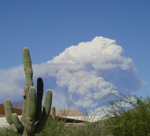
Willow Fire Pyro Cumulus Cloud

Return to Top
of Page

Welcome to Pepperridge North Valley's
Storm Analytical Page

Lightning Map Information

spacer
Storm Key:
Colour: Type:
Weak Thundershower Weak Thundershower
General Thundershower General Thundershower
Moderate Thundershower Moderate Thundershower
Thundershower Enhanced Thundershower
General Thundershower General Thunderstorm
Slightly Enhanced Thunderstorm Slightly Enhanced Thunderstorm
Enhanced Thunderstorm Enhanced Thunderstorm
Strong Thunderstorm Strong Thunderstorm
Enhanced Strong Thunderstorm Enhanced Strong Thunderstorm
Severe Thunderstorm Severe Thunderstorm
Enhanced Severe Thunderstorm Enhanced Severe Thunderstorm
Flash vs Stroke
Each stroke represents a single detection from the lightning detection hardware. But lightning actually occurs as flashes. Each flash is what we think of when we see a bolt of lightning.
Storm Analysis
Below is some examples of what storms will be identified as:

Storm Colour filled in/not filled in

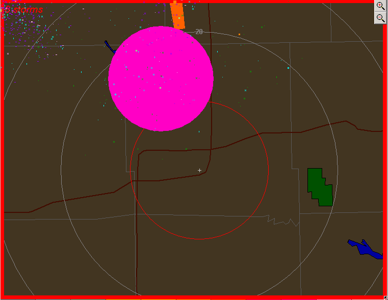
When a storm has been filled in with colour, it means there is a preponderance of +ve strokes, this means the storm has the potential to become more severe.

Lightning is very likely in area inside of the marked storm.

Storm Colour filled in/not filled in

When close flashes are detected and are more grouped together the storm detected will be in a round shape.
This means that lightning is extremely likely in the immediate area.
CID strokes or (Compact Intercloud Discharge) are Lightning primer strokes within the thunderstorm cloud they are usually only detected from relatively nearby storms within 150 miles (250 km) of the detector. It is rare to see more than one CID stroke per minute from a storm more than 100 miles (150 km) away. If the CID rate exceeds more that 5/min the storm is likely NEAR you. They are more prevalant in active storms and may account for 20 percent of intercloud strokes in a severe thunderstorm. On rare occasions CID strokes are detected from more distant storms.
Also if the Lightning Map appears to have a Yellow border, it signifies that there is Yellow Alert in place.
If the border is Red then it signifies there is a Red Alert in place.
Red Alerts occur when the stroke count exceeds 250 or when a storm moves inside the Red range ring.
When this happens a storm is occurring nearby.
This poses a very High risk of lightning occurring in the area.
If you are inside the red range ring and a red alert has been issued with a storm inside the ring:

1. Disconnect all electrical appliances.

2 .DO NOT take a shower or bath!

3. Move inside immediately if outside.

4. End any active phone calls.

The above instructions will help minimize the risk of getting struck.

Yellow Alerts occur when a storm is occurring in your region or is breaching 150 strokes.
If a Yellow Alert has been issued and you live inside the red or yellow range ring:
Keep an eye on the storm and periodically check where its heading.
If you start to notice the storm is getting closer and has a colour representing stronger thunderstorms:

It is recommended that you:

1. Clear and check your Gutters

2. Secure any loose objects outside.

3. Move any car residing outside into shelter.

4. Check local Doppler Radar and your local Meteorological Organization/Department.

5. If in the U.S turn on your NOAA Radio.

Lightning Safety Rules


When the weather forecast calls for thundershowers or thunderstorms, take it seriously. It means that lightning is possible. Lightning kills 125 people on the average each year in the United States and injures over 500. This makes it one of the most dangerous weather events in terms of lives lost.

Follow these lightning safety rules and it may save your life.

When thunderstorms are forecast, keep an eye on the sky and when a thunderstorm threatens, stay indoors or in an automobile (not a convertible).

Do not use the telephone except for emergencies.

If you are caught outside, avoid tall, isolated trees and utility poles. Avoid projecting above the landscape; don't stand on a hilltop. In a forest seek shelter in a low area under a thick growth of small trees. In open areas go to a low place such as a ravine or valley.

Get off and away from open water. Avoid tractors, farm equipment, motorcycles, golf carts and other metal vehicles. Avoid lines, wire fences, metal pipes and railings. Put down golf clubs. If you are in a group in the open stay several yards apart.

If you are caught in an open area far from shelter, and you feel your hair stand on end, lightning may be about to strike you. Drop to your knees and bend forward putting your hands on your knees. DO NOT lie flat on the ground.


Persons struck by lightning receive a severe electrical shock and burns, but they carry no electrical charge. Handling the victim will cause you no harm. Prompt action can revive someone "killed". When a group has been struck, treat the "apparently dead" first.

The American Red Cross says that if a victim is not breathing, give mouth-to-mouth resuscitation until medical help arrives. If the victim is not breathing and has no pulse, the properly trained should administer cardiopulmonary resuscitation (CPR).

Victims who appear stunned or otherwise unhurt may also need attention. Check for burns especially at fingers and toes and next to buckles and jewelry.


Member of the:
LightningRing

World Weather Websites

 Pepper Ridge North Valley Random Weather Facts

HEAT
Although Phoenix residents may feel that their city MUST be the hottest place around at times, the hottest temperatures in the state occur along the Colorado river in cities such as Bullhead City, Lake Havasu City, Parker or Yuma. In fact the top State honors go to Lake Havasu City, where the mercury climbed to 128° on June 29, 1994. This bests the Phoenix mark of 122°, set on June 26, 1990.

Get the Facts PHP


Page layout last updated on Jan 3rd, 2011