Welcome to the Pepper Ridge North Valley's
Severe Weather Page
This is your weather warning resource page. Check this page for the latest watches and warning updates,
from The National Weather Service, Phoenix, Az.!
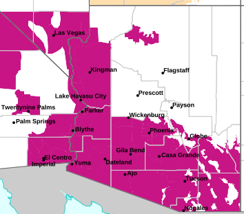
MAP OF CURRENT SOUTHWEST WATCHES, WARNINGS AND ADVISORIES
Local & Regional Weather Statements, Watches And Warnings
Weather Alerts for Pinal CountyIssued by the National Weather Service |
 FLOOD WATCH FLOOD WATCH |
| PINAL COUNTY |
Areas Affected:
Upper Santa Cruz River and Altar Valleys including Nogales - Tucson Metro Area including Tucson/Green Valley/Marana/Vail - South Central Pinal County including Eloy/Picacho Peak State Park - Southeast Pinal County including Kearny/Mammoth/Oracle - Upper San Pedro River Valley including Sierra Vista/Benson - Eastern Cochise County Below 5000 Feet including Douglas/Willcox - Upper Gila River and Aravaipa Valleys including Clifton/Safford - Galiuro and Pinaleno Mountains including Mount Graham - Chiricahua Mountains including Chiricahua National Monument - Dragoon/Mule/Huachuca and Santa Rita Mountains including Bisbee/Canelo Hills/Madera Canyon - Santa Catalina and Rincon Mountains including Mount Lemmon/Summerhaven |
| Effective: Sun, 9/13 11:52am |
Updated: Sun, 9/13 9:42pm |
Urgency: Future |
| Expires: Mon, 9/14 5:30am |
Severity: Severe |
Certainty: Possible |
|
Details:
* WHAT...Flash flooding caused by excessive rainfall is possible.

* WHERE...A portion of Southeast Arizona, including the following
areas, Catalina and Rincon Mountains, Chiricahua Mountains, Dragoon
and Mule and Huachuca and Santa Rita Mountains, Eastern Cochise
County below 5000 feet, Galiuro and Pinaleno Mountains, South
Central Pinal County, Southeast Pinal County, Tucson Metro Area,
Upper Gila River Valley, Upper San Pedro River Valley and Upper
Santa Cruz River Valley/Altar Valley.

* WHEN...From Monday morning through Monday evening.

* IMPACTS...Excessive runoff may result in flooding of rivers,
creeks, streams, and other low-lying and flood-prone locations.
Creeks and streams may rise out of their banks. Low-water crossings
may be flooded.

* ADDITIONAL DETAILS...
- Well above normal moisture levels for September are expected to
result in scattered to numerous showers and thunderstorms capable
of producing heavy rainfall Monday. Rain totals of 1 to 2 inches
are expected with the stronger storms with isolated amounts over
2 inches possible. Areas that received substantial rainfall in
the 48 to 72 hours will be more susceptible to flash flooding.
This rainfall will result in faster response in washes, creeks,
and storm drainages.
- http://www.weather.gov/safety/flood
Information:
You should monitor later forecasts and be prepared to take action
should Flash Flood Warnings be issued. |
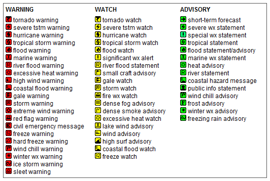
Key to Icons for Local & Regional Weather Statements, Watches And Warnings
Map of the Current Watches, Warnings, and Advisories Nationwide:

|
|
Member of the:


|
North Valley Random Weather Facts |
WIND CHILL
Wind Chill - The wind chill temperature is what the temperature "feels like" to people and animals during cold weather. Wind chill is based on the rate of heat loss from exposed skin caused by wind and cold. As the wind increases, it draws heat from the body, driving down skin temperature and eventually the internal body temperature. Once temperatures drop below 10 °F and the wind is gusting, conditions are ripe for cold-related illnesses. Below -5 °F, any wind is a major factor in frostbite and hypothermia.
Get the Facts PHP
|
|
Page layout last updated on Mar 8th, 2024
|
|
|


 New Feature