Welcome to the Pepper Ridge North Valley's
Severe Weather Page
This is your weather warning resource page. Check this page for the latest watches and warning updates,
from The National Weather Service, Phoenix, Az.!
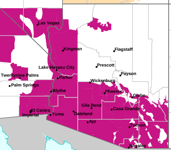
MAP OF CURRENT SOUTHWEST WATCHES, WARNINGS AND ADVISORIES
Local & Regional Weather Statements, Watches And Warnings
Weather Alerts for Globe/Miami/SuperiorIssued by the National Weather Service |
 FLOOD WATCH FLOOD WATCH |
| GLOBE/MIAMI/SUPERIOR |
Areas Affected:
Aguila Valley - Northwest Valley - Cave Creek/New River - Deer Valley - New River Mesa - Rio Verde/Salt River - Fountain Hills/East Mesa - Superior - Apache Junction/Gold Canyon - Tonto Basin - Mazatzal Mountains - Pinal/Superstition Mountains - San Carlos - Dripping Springs - Globe/Miami - Southeast Gila County |
| Effective: Sun, 9/27 12:29pm |
Updated: Sun, 9/27 3:26pm |
Urgency: Future |
| Expires: Mon, 9/28 5:00am |
Severity: Severe |
Certainty: Possible |
|
Details:
* WHAT...Flooding caused by excessive rainfall continues to be
possible.

* WHERE...A portion of south central Arizona, including the following
areas, Aguila Valley, Apache Junction/Gold Canyon, Cave Creek/New
River, Deer Valley, Dripping Springs, Fountain Hills/East Mesa,
Globe/Miami, Mazatzal Mountains, New River Mesa, Northwest Valley,
Pinal/Superstition Mountains, Rio Verde/Salt River, San Carlos,
Southeast Gila County, Superior and Tonto Basin.

* WHEN...From late Monday night through Tuesday evening.

* IMPACTS...Excessive runoff may result in flooding of rivers,
creeks, streams, and other low-lying and flood-prone locations.

* ADDITIONAL DETAILS...
- The combination of deep tropical moisture moving into the area
from the south and an approaching weather disturbance from the
west will result in showers and thunderstorms capable of
producing localized heavy rainfall. Moderate to heavy rainfall
rates in excess of 1-2 inches per hour are expected. Some areas
will see training of storms leading to heavier rainfall
accumulations.

- Http://www.weather.gov/safety/flood
Information:
You should monitor later forecasts and be alert for possible Flood
Warnings. Those living in areas prone to flooding should be prepared
to take action should flooding develop. |
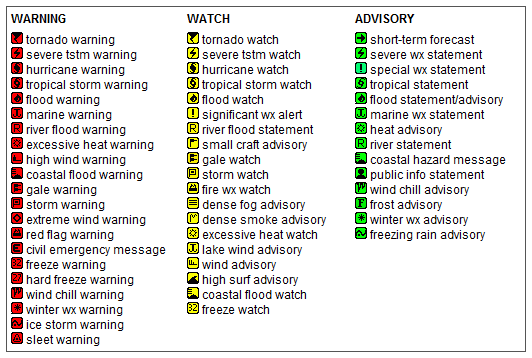
Key to Icons for Local & Regional Weather Statements, Watches And Warnings
Map of the Current Watches, Warnings, and Advisories Nationwide:

|
|
Member of the:


|
North Valley Random Weather Facts |
HEAT INDEX
The Heat Index (HI) (or apparent temperature) is a measure of relative discomfort due to combined heat and high humidity. It was developed by R.G. Steadman (1979) and is based on physiological studies of evaporative skin cooling for various combinations of ambient temperature and humidity. As temperatures climb above 90 °F and humidity goes above 40 percent, conditions are ripe for heat-related illnesses.
Get the Facts PHP
|
|
Page layout last updated on Mar 8th, 2024
|
|
|


 New Feature