Skip to main content.
Currently:84.9°F Dry
Dry
Comfort Index: ---
 Updated22-Apr-2025 6:40pm @ 
 
Time of Next Full Update: 6:45 pm -  Station Elev: 1469 ft  
Pepper Ridge North Valley - Lightning Navigation Menu
Pepper Ridge North Valley - Main Naviagation Menu

Weather Links:

       Home Page 

      Current Weather 

           Forecast Page 

          Historical Data

           Live Lightning 

            Monsoon Info 

        Satellite/Radar 

       Station Info

     Tropical Weather

        Weather Ed. 101 

          Weather Links 

      Weather Photos 

  Weather Warnings

       More Wthr Links 

Us Flag

New FeatureNew Feature
N.O.A.A Radio

Celebrating
20 Years on the web
2005 - 2025

& 25+ Years of Data
1997 - 2025
At Pepper Ridge

 Weather Reports: 
Monsoon 2024New Feature
 Highlights. 

Monsoon 2021New Feature
 Wrap Up Review. 

Monsoon 2020
 Wrap Up Review. 

Monsoon 2015
 Review. 

Side Bar Php

Current Conditions

@ 22-Apr-2025 6:40pm
84.9°F Colder 2.2°F than last hour.
Temp Change: °F /hr
Dry  Dry
Feels Like: 82 °F
Humidity: 16
Dew Point: 33.7 °FDecreased 1.8°F since last hour.
Wind: Calm
---

 mph
Gust: 0.0 mph
Pressure: 29.70 in Falling 0.009 inHg/hour
Steady
Solar Rad: 85%
39 W/m2
UV Index: 0.0
None
Rain Today: 0.00 in
Rain Rate: 0.000 in
Rain Month: 0.19 in
Rain Year: 1.55 in

Almanac

Sunrise: 5:48 am
Sunset: 7:03 pm
Moonrise: 2:44 am
Moonset: 1:29 pm
Waning Crescent Moon
Waning Crescent Moon, Moon age: 23 days,21 hours,8 minutes,32%
32%
Illuminated

Daily Min/Max

Today's High Temp: 88.6°F
3:22pm
Today's Low Temp: 56.0°F
5:14am
Today's High Humidity: 47%
5:16am
Today's Low Humidity: 15%
3:25pm
Today's High Dewpoint: 39.5°F
8:28am
Today's Low Dewpoint: 33.7°F
6:39pm
Today's High Barometric Pressure: 29.860 in/Hg
9:28am
Today's Low Barometric Pressure: 29.701 in/Hg
6:34pm
Today's High Wind Speed: 12.0 mph
4:16pm
Today's
High UV:
4.7
 Medium 
12:06pm
Today's
High Solar:
991 W/m2
12:17pm
Today's High Rain Rate: 0.000 in/min
5:00pm
Today's High
Hourly Rain Rate:
0.000 in/hr
Days Since
Last Rain:
3 Days

Current NWS Alerts:


No alerts

Lower Sidebar Page
Pepper Ridge Weather Station
USA Weather Finder
United States Weather Group
Wunderground

Sky Warn

CWOP 3794 Quality Control Logo
CW 3794

For more information
about this site
contact the
Web Master

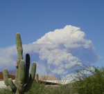
Willow Fire Pyro Cumulus Cloud

Return to Top
of Page

lightning stike

PEPPERRIDGE NORTH VALLEY'S
SOUTHWEST LIGHTNING TOA

lightning stike

Microferics TOA Lightning Display

Microsferics TOA Lightning Network

The TOdA (Time Of difference of Arrival) system is a network based lightning triangulation method
by employing multiple volunteer detection sites across Europe and North America. It provides high accuracy
detection which augments the participating stations existing lightning detection systems.

SW Lightning - Pepper Ridge North Valley is part of this project and supplies data to the TOdA network

Regional mLDN TOA Network 2 hr Lightning Plot
- updates automatically every 30 seconds -
(The Default setting Displays data within 438 miles of - Pepperridge North Valley) :

Network Stations are shown by the small Green dots
Use the Zoom Controls to see different distance plots

6 Hr Lightning time lapse: (Updates every 5 minutes)

Hover over for controls (near the center bottom of map) to manually control the Time lapse.
Otherwise it Runs Automatically (see lower right corner of map).

The Regional Lightning Network Coverage Map:

Network Stations are shown by the small White dots

coverage map

The Local Lightning Network Coverage Map:

Network Stations are shown by the small White dots

Visit the Microsferics Home Page for more real-time maps and information on the network.

Note: Until there are more stations are reporting in Arizona and the Southwest Region strike display is limited.
Own a PWS in the US (especially AZ)? please Contact the Network if interested in joining.
NOTE: Operating a Boltek Lightning Detection System is no longer required to participate.


Regional lightning detection is here, just in time to track the monsoon season thunderstorms. The lightning detection system consists of a Boltek™ lightning detector and a TOA Kit to receive and send data to Microferics server for lightning analysis. The TOdA (Time Of difference of Arrival) system is a network based lightning dectection system which utilizes the triangulation method for more accurate plotting of Lightning strikes.


Disclaimer Note: Remember do not based your outdoor plans or activities solely on the lightning information provided here, this lightning display is for informational purposes only, and not intended to be used, for the protection of life or property. Remember to follow the, Lightning Safety Rules!, especially if thunderstorms are nearby!


Additional Live Lightning Links:

Aninoquisi Lightning Detector Map

Lightning Explorer Free Page

Pepper Ridge North Valley - Southwest Lightning

National & Regional Lightning MapsNew Feature

Microsferics Real-Time Lightning - North America

Microsferics Real-Time Lightning - Regional New Feature

Weather Bus Lightning Gold Canyon, Az

Nexstorm Testing Page


Please Stay Safe this Summer and Observe the following;
Lightning Safety Rules!


Scientific Radar View
Ground Clutter Not Removed!

Radar Updates Approximately Every 10 Minutes
Station Location is marked CW3794


Southwestern Weather Network - Radar and Lightning!

   This map displays a view of lightning data and radar - Over the entire Southwestern United States!
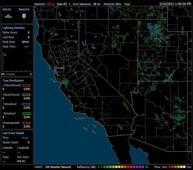
   SWN Lightning/Radar

Regional Lightning data/Radar Map Courtesy of Astrogenic and StrikeStar US.
Data supplied by Southwestern Weather Network members and others.


Member of the:
LightningRing

World Weather Websites

 Pepper Ridge North Valley Random Weather Facts

ADVISORIES
A statement generally provides additional or follow up information to an existing weather condition. An advisory is for less serious conditions that cause significant inconvenience and, if caution is not exercised, could lead to situations that may threaten life and/or property. A watch is used when the risk of a hazardous weather event has increased significantly, but its occurrence, locations, and/or timing is still uncertain. It is intended to provide advance notice of possible inclement weather. A warning is used for conditions posing an immediate threat to life or property. Depending on the type of warning, you should take immediate, appropriate action.

Get the Facts PHP


Page layout last updated on August 18th, 2019